File:MilkyWayPoliticalMap.jpg
Jump to navigation
Jump to search

Size of this preview: 600 × 600 pixels.
Original file (800 × 800 pixels, file size: 131 KB, MIME type: image/jpeg)
This is a map of the Milky Way divided into political regions as used in the Blue Giant Setting.
File history
Click on a date/time to view the file as it appeared at that time.
| Date/Time | Thumbnail | Dimensions | User | Comment | |
|---|---|---|---|---|---|
| current | 21:41, 8 November 2005 | | 800 × 800 (131 KB) | TrapperQ (talk | contribs) | This is a map of the Milky Way divided into political regions as used in the Blue Giant Setting. |
| 21:41, 8 November 2005 | 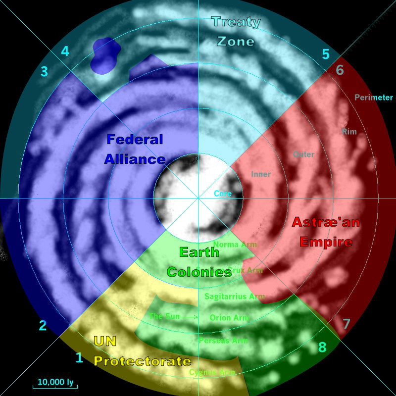 | 800 × 800 (131 KB) | TrapperQ (talk | contribs) | This is a map of the Milky Way divided into political regions as used in the Blue Giant Setting. |
You cannot overwrite this file.
File usage
The following page uses this file: