Telkarion Maps: Difference between revisions
Jump to navigation
Jump to search
No edit summary |
No edit summary |
||
| Line 6: | Line 6: | ||
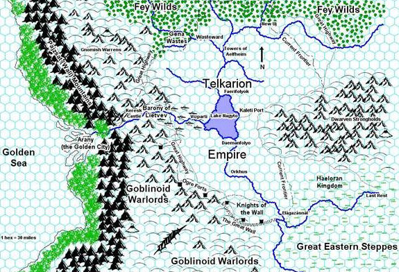
A map of the Empire and neighbouring realms. Wasteward Keep is located on the northwestern border of the Empire. Scale is actually more like 1 hex = 60 miles. | A map of the Empire and neighbouring realms. Wasteward Keep is located on the northwestern border of the Empire. Scale is actually more like 1 hex = 60 miles. | ||
[[Image:Genasi Map.jpg]] | |||
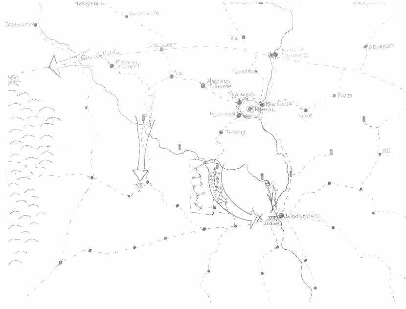
A map discovered by Trykaar on the body of a wagon driver, following an ambush by the party and their goblin allies on three wagons and their guards. | |||
Return to [[Telkarion]]. | Return to [[Telkarion]]. | ||
Latest revision as of 09:56, 26 November 2009
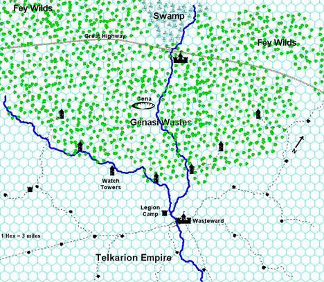
A map of the Wasteward Marches, the district centered around Wasteward Keep. Two noteable errors: the westernmost tower should be further southwest and the scale is actually more like 1 hex = 6 miles.
A map of the Empire and neighbouring realms. Wasteward Keep is located on the northwestern border of the Empire. Scale is actually more like 1 hex = 60 miles.
A map discovered by Trykaar on the body of a wagon driver, following an ambush by the party and their goblin allies on three wagons and their guards.
Return to Telkarion.


