Tyche's Favourites/Local Maps: Difference between revisions
Jump to navigation
Jump to search
Created page with "Here are some useful maps of the era, and some other images to help us get situated. Firstly, a sketch of what Massalia itself might have looked like (based on the archaeologica..." |
No edit summary |
||
| Line 1: | Line 1: | ||
Here are some useful maps of the era, and some other images to help us get situated. | Here are some useful maps of the era, and some other images to help us get situated. | ||
Latest revision as of 22:54, 14 June 2013
Here are some useful maps of the era, and some other images to help us get situated.
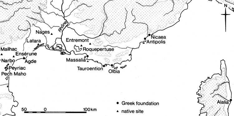
Two maps from the same source. Firstly all the major Greek and Gallic settlements:
Of particular note are Roquepertuse, Enserune and Pech Maho, which are oppidia, significant hilltop fortresses. Note that Entremont doesn't yet exist in 300BC.
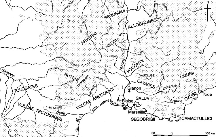
Here are the local tribes of the area:
Primarily Celto-Ligurian in the immediate area along the coast.
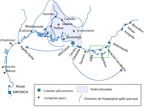
Here is a suggestion of Massalia's area of influence:
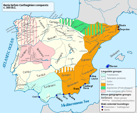
The indigenous tribes of Iberia:
You can just see the two Greek settlements of Emporiae and Rhode in the north-east, and all the Carthaginian trading posts in the south.


