Tyche's Favourites/Local Maps
Here are some useful maps of the era, and some other images to help us get situated.
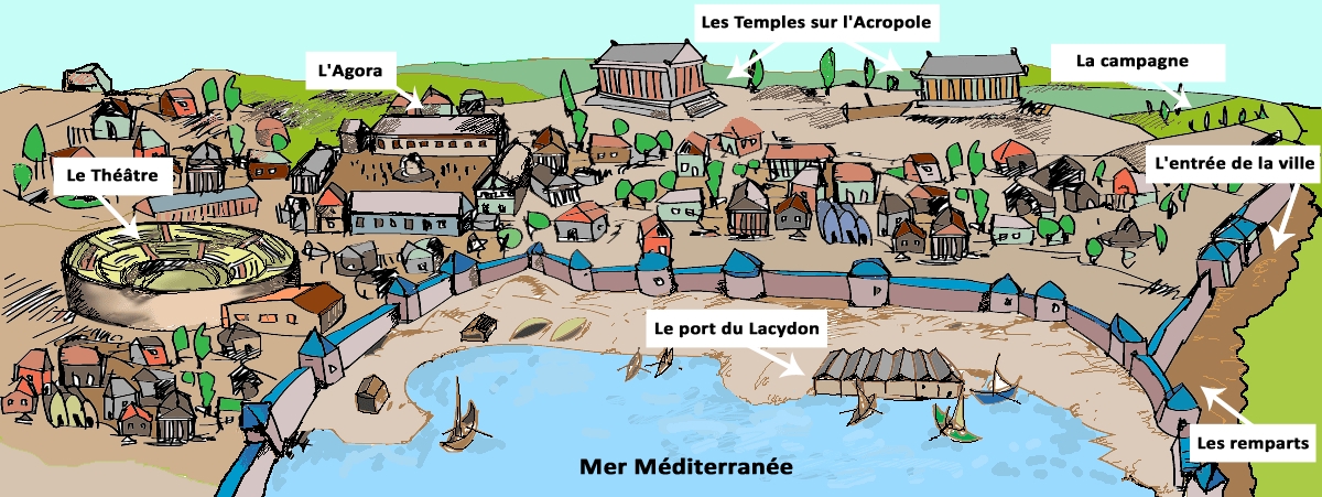
Firstly, a sketch of what Massalia itself might have looked like (based on the archaeological findings):
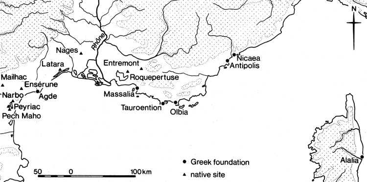
Two maps from the same source. Firstly all the major Greek and Gallic settlements:
Of particular note are Roquepertuse, Enserune and Pech Maho, which are oppidia, significant hilltop fortresses. Note that Entremont doesn't yet exist in 300BC.
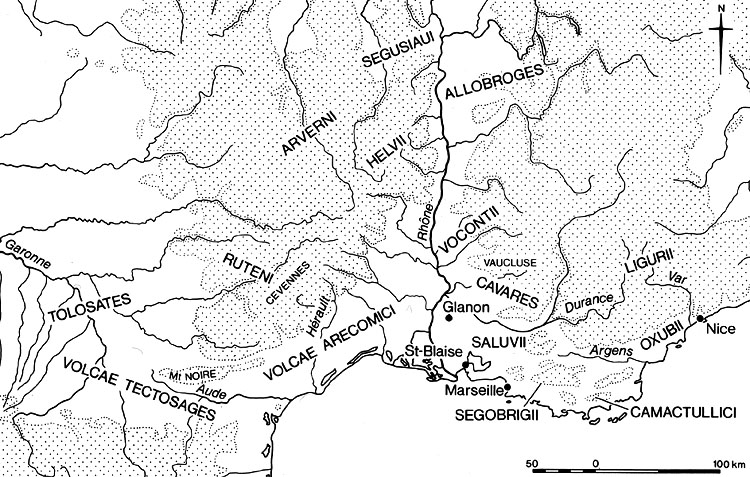
Here are the local tribes of the area:
Primarily Celto-Ligurian in the immediate area along the coast.
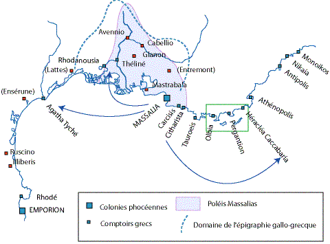
Here is a suggestion of Massalia's area of influence:
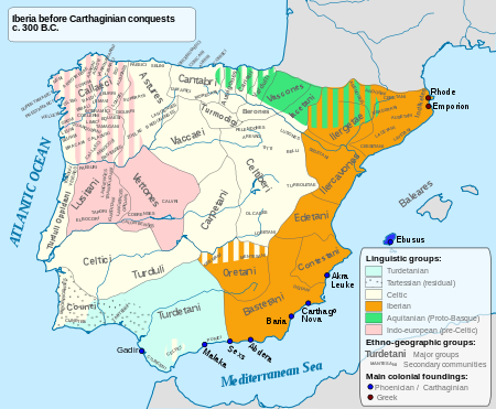
The indigenous tribes of Iberia:
You can just see the two Greek settlements of Emporiae and Rhode in the north-east, and all the Carthaginian trading posts in the south.
