File:WSmap.gif
Size of this preview: 446 × 600 pixels. Other resolution: 1,135 × 1,526 pixels.
Original file (1,135 × 1,526 pixels, file size: 173 KB, MIME type: image/gif)
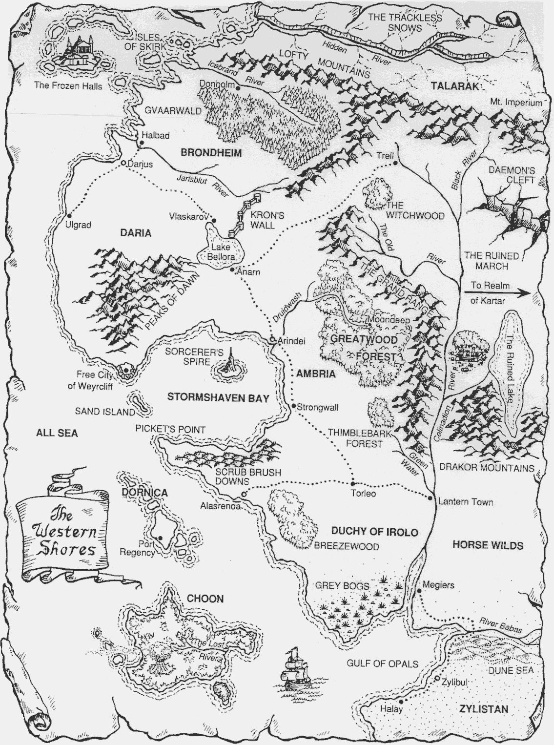
B&W named map of the Western Shores
File history
Click on a date/time to view the file as it appeared at that time.
| Date/Time | Thumbnail | Dimensions | User | Comment | |
|---|---|---|---|---|---|
| current | 00:55, 4 January 2006 | | 1,135 × 1,526 (173 KB) | Curufea (talk | contribs) | B&W named map of the Western Shores |
You cannot overwrite this file.
File usage
The following page uses this file: