Difference between revisions of "Blue Giant:Galactic Maps"
m |
|||
| Line 5: | Line 5: | ||
[[Image:MilkyWaySectorMap.jpg]] | [[Image:MilkyWaySectorMap.jpg]] | ||
| + | |||
==Political Map of the Milky Way== | ==Political Map of the Milky Way== | ||
| + | |||
This map shows the divisions of the galaxy according to the [[Blue_Giant:History#The Groombridge Accord|The Groombridge Accord]] and [[Blue_Giant:History#The Federal / Imperial Treaty|The Federal / Imperial Treaty]]. | This map shows the divisions of the galaxy according to the [[Blue_Giant:History#The Groombridge Accord|The Groombridge Accord]] and [[Blue_Giant:History#The Federal / Imperial Treaty|The Federal / Imperial Treaty]]. | ||
Revision as of 14:53, 8 November 2005
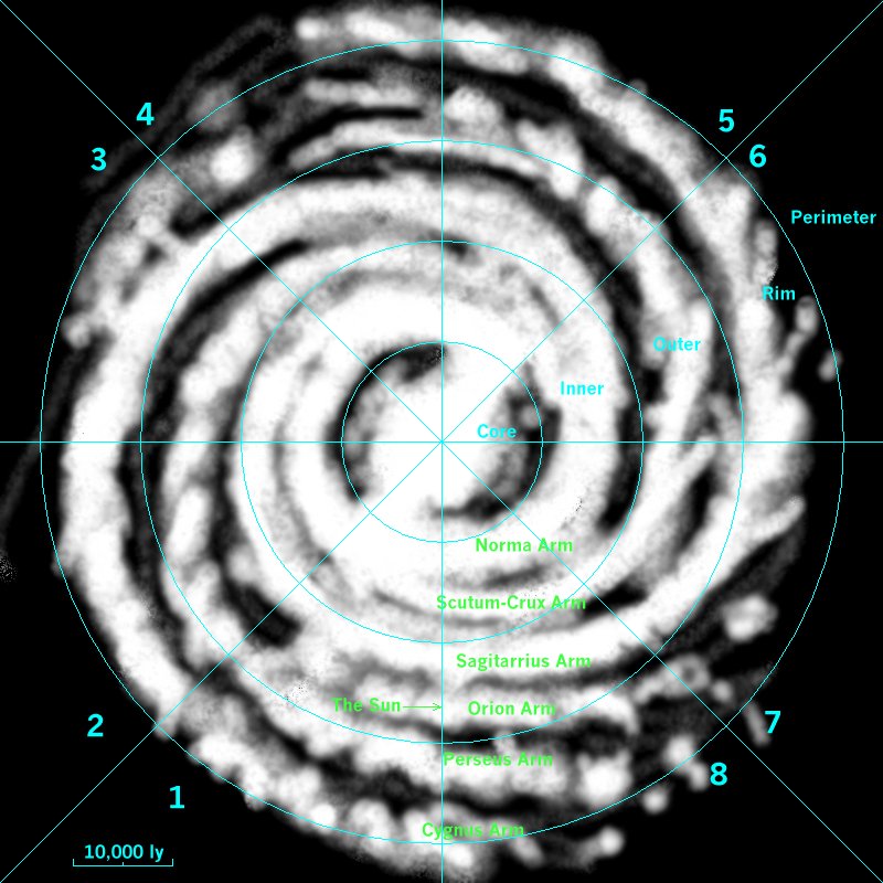
Sector Map of the Milky Way
This map shows the various sectors of the galaxy. The galaxy is split into eight radial sectors, each of which has five zones which are Core, Inner, Outer, Rim, and Perimeter. The borders of each zone occur in 10,000 light years steps from the centre of the galaxy.
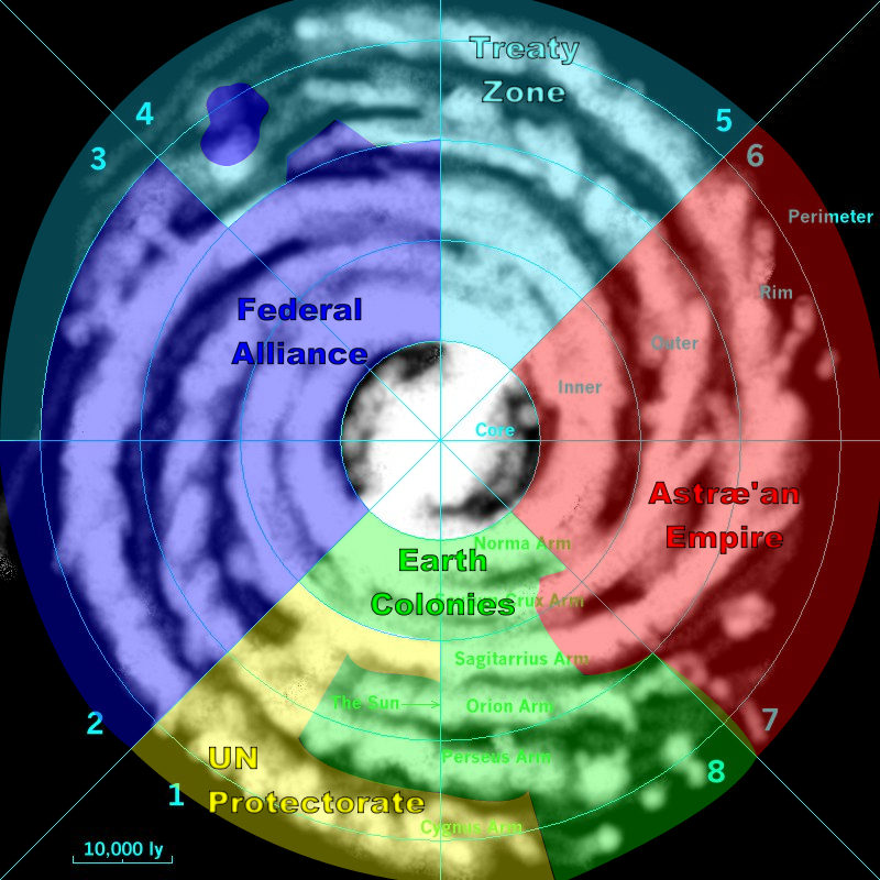
Political Map of the Milky Way
This map shows the divisions of the galaxy according to the The Groombridge Accord and The Federal / Imperial Treaty.

