File:Quadrant 15 and nearby sectors.png
Revision as of 20:56, 3 July 2023 by Fedifensor (talk | contribs) (Map of the sectors of space near Quadrant 15.)
Size of this preview: 800 × 552 pixels. Other resolutions: 320 × 221 pixels | 1,424 × 983 pixels.
Original file (1,424 × 983 pixels, file size: 239 KB, MIME type: image/png)
Summary[edit]
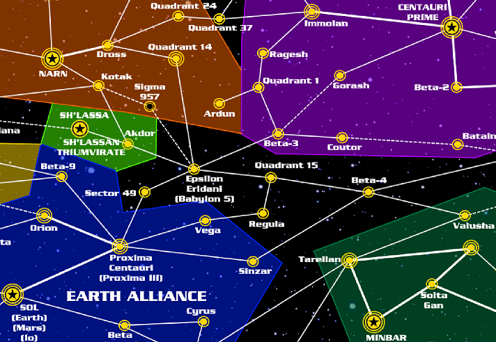
Map of the sectors of space near Quadrant 15.
File history
Click on a date/time to view the file as it appeared at that time.
| Date/Time | Thumbnail | Dimensions | User | Comment | |
|---|---|---|---|---|---|
| current | 20:56, 3 July 2023 | | 1,424 × 983 (239 KB) | Fedifensor (talk | contribs) | Map of the sectors of space near Quadrant 15. |
| 20:56, 3 July 2023 |  | 1,424 × 983 (239 KB) | Fedifensor (talk | contribs) | Map of the sectors of space near Quadrant 15. |
- You cannot overwrite this file.
File usage
There are no pages that link to this file.