Scarlet Principalities Regional Maps

From RPGnet
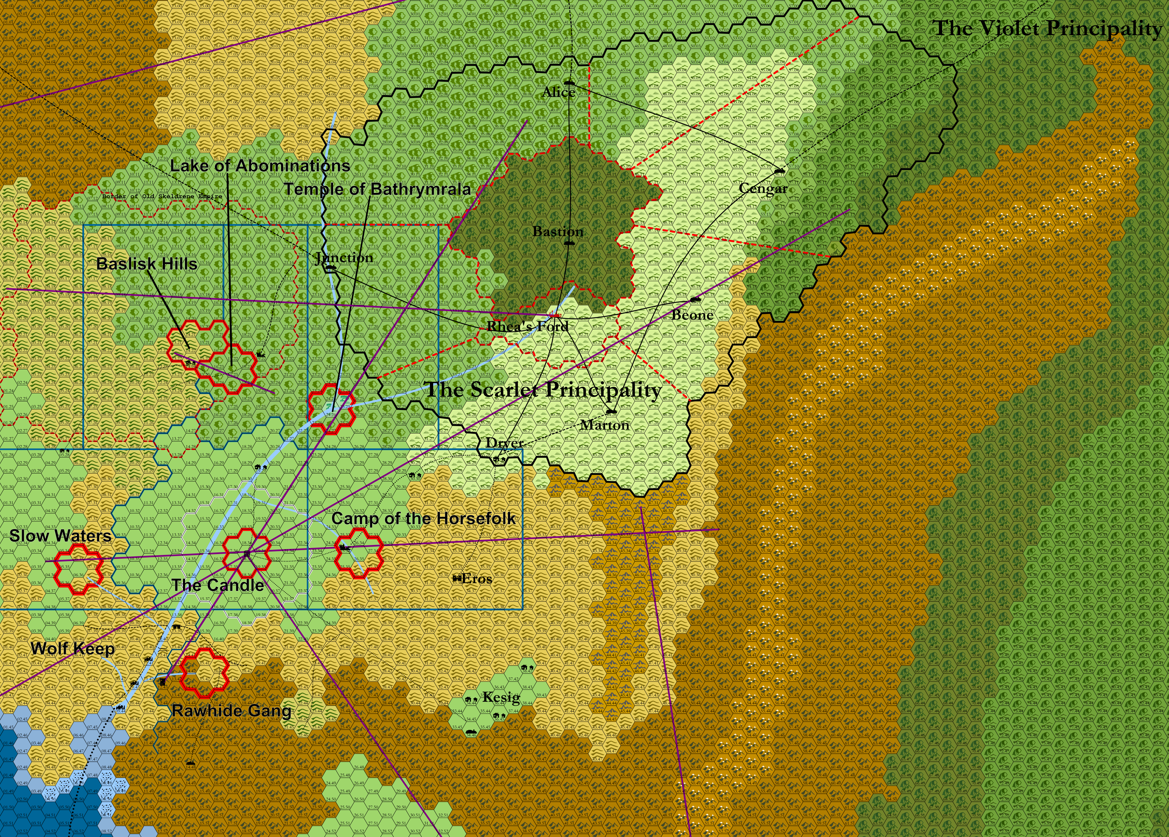
Revision as of 05:15, 1 December 2021 by Thirdkingdom (talk | contribs) (Created page with " *Each hex = 6 miles *Purple lines are ley lines *Thick red lines are existing hex clusters *Dashed red lines are political borders within the Scarlet Principalities *Blue...")
(diff) ← Older revision | Latest revision (diff) | Newer revision → (diff)
Jump to: navigation, search

[[

  • Each hex = 6 miles
  • Purple lines are ley lines
  • Thick red lines are existing hex clusters
  • Dashed red lines are political borders within the Scarlet Principalities
  • Blue lines are borders of the planned supplemental hex crawls.

Scarlet Principality Region Everything Map.png